

ISBN online: 978-80-7701-098-6 | DOI: 10.11118/978-80-7701-098-6
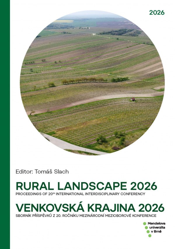
RURAL LANDSCAPE 2026: 20th INTERNATIONAL INTERDISCIPLINARY CONFERENCY / VENKOVSKÁ KRAJINA 2026: 20. ROČNÍK MEZINÁRODNÍ MEZIOBOROVÉ KONFERENCE
23.–24. 4. 2026 Čejkovice
- Tomáš Slach (Ed.)
Sborník příspěvků z jubilejního 20. ročníku mezinárodní mezioborové konference Venkovská krajina nabízí možnost ohlédnutí za pestrou paletou témat, která byla na akci konané v květnu 2026 v jihomoravských Čejkovicích představena. V rozmanitosti zaměření jednotlivých příspěvků se odráží rozmanitost současné venkovské krajiny střední Evropy, i různorodost přístupů, jež lze využít ve snaze o minimalizaci negativních vlivů, jimž je vystavena, a podpoře pozitivních procesů a hodnot, které si zachovává.
online: 2026, vydavatel: Mendel University in Brno
 |
Příspěvky konference
LANDSCAPE CHANGES IN PROTECTED LANDSCAPE AREAS AND THEIR SURROUNDINGS
Tomáš Janík, Roman Borovec, Anna Lichová, Alois Vokoun, Marek Havlíček
DOI: 10.11118/978-80-7701-098-6-0008
This paper focuses on landscape changes in selected Protected Landscape Areas (PLAs). We analyzed the period from the 1950s to 2020 using four time milestones (1950s, 1990, 2004, and 2020) within the selected PLAs and their 3 km buffers (both as a whole and within 1 km zones) to reveal differences in land-use change between these areas. Changes in arable land, permanent grassland, built-up areas, and buildable areas were evaluated. Across ten study areas—(1) Beskydy + Bílé Karpaty; (2) Blanský les + Šumava PLA and National park (NP); (3) Blaník; (4) Brdy; (5) Litovelské Pomoraví; (6) Moravský kras; (7) Poodří; (8) Pálava + Soutok; (9) Třeboňsko; and (10) Český les—arable land and built-up areas were significantly less represented within PLAs than in the surrounding buffers throughout the study period. In contrast, forest cover was more prevalent within PLAs. Moreover, buildable areas were more frequently located in the buffer zones, similarly to built-up areas, particularly within the closest 1 km buffer from the PLA boundaries. Although the trends in land-use change were similar across PLAs and buffers, the proportional shares differed significantly. The results indicate that landscape connectivity and ecological functioning beyond protected area boundaries may be threatened by differing land-use approaches.
HISTORIC URBAN PARKS AS BIODIVERSITY REFUGEES IN CULTURAL LANDSCAPES
Ivo Machar, Pavel Borusík, Vilém Pechanec
DOI: 10.11118/978-80-7701-098-6-0014
Large urban parks in European cultural landscapes are well-known as habitats with high local bird diversity. In this study, we have studied the bird community in historic urban park in Olomouc heritage city (Czech Republic) using bird territory mapping in 2005 and 2008 years. Results revealed the bird community in historic urban park was very rich in abundance and species diversity in investigated period. These results supported emerging idea that large historic parks can be considered as important refugees for bird diversity in cultural landscapes. Implications of results for sustainable management of urban green environment (especially in the frame of maintaining the very large old trees providing heterogeneity of nest habitats) are discussed.
ASSESSING ACCUMULATED HEAT UNITS FOR BBCH-SCALED GROWTH STAGES OF QUERCUS CERRIS L. IN BAB FOREST
Sabica Naz, Tomas Rusnak, Lubos Halada
DOI: 10.11118/978-80-7701-098-6-0020
Quercus cerris L. is a common tree species in the lowland forests of Central Europe, and its temperature requirements for the full annual growth cycle have not been assessed enough. This study recorded the BBCH-scaled growth stages of Q. cerris in Bab Forest near Nitra, Slovakia, during 2025, and calculated the accumulated heat units (AHU) required to complete all growth phases. AHU was calculated from daily air temperature data with a base temperature of 5 °C. Findings confirmed that full foliage required the most AHU 1,569.8 °C in the duration of 109 days, fruit development at 1,067.7 °C, and fruit maturation at 789.1 °C, respectively. Spring phases completed their growth cycle in a short duration, with budburst in early spring and leaf development in late spring, and these stages recorded the lowest AHU values, along with the senescence phase. Phenophase duration and AHU showed a positive Spearman correlation (ρ = 0.74). The AHU values for Q. cerris assessed in this study will be useful in phenological modelling and climate adaptation planning.
Changes in Land Use and Diversity of Agricultural Landscape: A Case Study of the Tribeč and Žitava Upland Interface (Kolíňany, Žirany)
Peter Petluš, Viera Petlušová, Renáta Klimanová
DOI: 10.11118/978-80-7701-098-6-0025
The presented study analyses the spatio-temporal dynamics of the agricultural landscape at the interface of the Tribeč Mountains and the Žitava Upland across three key periods: 1949 (pre-collectivization mosaic), 2018–2024 (large-block management), and 2025 (implementation of strip-cropping). Quantitative analysis using landscape metrics (e.g., SHDI, Edge Density, Patch Density) documents a radical transformation of the area, where initial high diversity (138 patches) declined due to collectivization into extreme homogenization (3 patches). However, the introduction of strip-cropping in 2025 demonstrated a significant increase in edge density (from 107 m/ha to 447 m/ha) and reached a historical maximum in the evenness index (0.876). The research confirms that although temporal crop diversity (TDCI = 0.625) did not numerically increase with the introduction of strips, a fundamental qualitative optimization of the landscape's spatial configuration occurred. This approach enhances ecological stability, creates mechanical barriers against water erosion, and restores the functional texture of the agricultural matrix.
PUBLIC ATTITUDES TOWARD CLIMATE CHANGE ADAPTATION MEASURES IN THE CZECH LANDSCAPE
Jana Stachová, Daniel Čermák
DOI: 10.11118/978-80-7701-098-6-0038
This paper examines public attitudes toward climate change adaptation measures in the Czech landscape, including forests, agricultural land, water systems, and ecosystems. The analysis is based on a representative survey of 1,075 respondents conducted in 2024 and combines descriptive statistics with exploratory factor analysis. The results show generally high levels of support for nature-based and ecosystem-oriented measures, particularly those framed as collectively beneficial interventions such as wetland restoration and ecosystem recovery. In contrast, more specific or restrictive measures tend to receive more moderate support. The factor analysis identifies several cross-cutting dimensions of attitudes, including support for state-led conservation, regulatory approaches, adaptive management strategies, and forest management interventions. Additional analyses indicate modest variation across socio-demographic groups. The findings suggest that public acceptance of adaptation policies depends both on the type of measure and its perceived impact on individual behaviour. In the Czech context, policies emphasizing ecosystem benefits are likely to gain broader support, while more restrictive measures may require targeted communication and stakeholder engagement.
BIOKLIMATICKÁ OPATŘENÍ VE VEŘEJNÉM PROSTORU VENKOVSKÝCH SÍDEL: TRADICE – ADAPTACE – INOVACE
BIOCLIMATIC INTERVENTIONS IN RURAL PUBLIC SPACES: TRADITION – ADAPTATION – INNOVATION
Barbora Dohnalová
DOI: 10.11118/978-80-7701-098-6-0048
The paper addresses the climate vulnerability of rural settlements and the absence of specific methodological procedures for their adaptation. The purpose of the study is to define the concept of bioclimatic furniture and architectural elements as tools for micro-interventions at the scale of rural municipalities. The methodology is based on qualitative research and a comparative analysis of original designs using a newly defined “bioclimatic profile” – a matrix of five attributes: water management, biogenic cooling, radiation reflectance, aerodynamics, and solar optimization. The results are demonstrated through the implementation of a bioclimatic bus stop in Ratiboř utilizing adiabatic cooling and an architectural study of a farm building conversion in a South Moravian brownfield, where traditional elements (perforated masonry, light shades) serve as functional adaptation measures. The main conclusion is that the synergy of historical tradition and technological innovation enables the creation of low-maintenance and economically sustainable solutions that significantly increase thermal comfort and the overall climate resilience of rural public spaces in accordance with the strategic goals of the Czech Republic while reflecting the traditional character of both the settlement and the landscape.
FRAGMENTACE KRAJINY DOPRAVNÍ INFRASTRUKTUROU A JEJÍ KONEKTIVITA
FRAGMENTATION CAUSED BY TRANSPORTATION INFRASTRUCTURE AND LANDSCAPE CONNECTIVITY
Ivo Dostál, Marek Havlíček
DOI: 10.11118/978-80-7701-098-6-0059
Landscape fragmentation caused by linear transport networks is a critical threat to global biodiversity and ecosystem health. This paper examines the multifaceted impacts of road and rail structures on landscape connectivity, distinguishing between structural continuity and functional connectivity for various species, including aspects of human society. Using the infrastructure life cycle as a framework, the study applies the internationally recognised mitigation hierarchy Avoidance, Mitigation and Compensation to address both ecological and social barrier effects. During the strategic planning phase, the focus is on avoiding ecological network conflict points and integrating spatial planning. In the design stage, the paper emphasises the transition from technocratic engineering to Nature-Based Solutions (NBS). These solutions, such as multi-functional migration passages and vegetated soil berms, enhance biodiversity, water retention, and climate resilience. The article further discusses the necessity of continuous monitoring, biological supervision, and the use of roadkill databases to identify mortality hot-spots. Finally, it highlights the often-overlooked decommissioning phase as a vital tool for rewilding and restoring natural connectivity. An integrated, multidisciplinary approach throughout the entire life cycle is presented as the essential path toward achieving ecologically sustainable transport networks that balance human mobility with environmental preservation.
EVIDENCE LESA V 19. STOLETÍ: CO NÁM (NE)ŘÍKAJÍ VÝKAZY PLOCH STABILNÍHO KATASTRU?
FOREST RECORDS IN THE 19TH CENTURY: WHAT DOES THE LAND AREA REGISTER OF THE STABLE CADASTRE (NOT) TELL US?
Petr Dujka
DOI: 10.11118/978-80-7701-098-6-0067
This study examines the reliability of forest area data in the Land Area Register of the Stable Cadastre, which is frequently used as a source of information on land use in the mid-19th century. The aim was to assess the extent to which these data correspond to the actual extent of forest parcels recorded in the maps and written records of the Stable Cadastre. The analysis was conducted on a set of 37 cadastral units of the former Brumov estate (Brumov I–III) located on the Moravian–Slovak border. The results show that the areas of high forest and coppice recorded in the Land Area Register correspond to the areas of forest parcels identified in the indication sketches. In contrast, the aggregate category “Forests” in the Land Area Register consistently shows higher values. This discrepancy is likely due to the inclusion of additional subcategories, particularly shrubland, recorded under the broader category Holzland. The study highlights the interpretative limitations of the Land Area Register and emphasizes the need for critical use of secondary sources in the reconstruction of historical land use.
MOŽNOSTI ŠÍRENIA NEPÔVODNÝCH DRUHOV VO VIDIECKEJ KRAJINE: KORIDORY, VEKTORY, STANOVIŠTIA
POSSIBILITIES FOR THE SPREAD OF ALIEN PLANTS IN RURAL LANDSCAPE: CORRIDORS, VECTORS AND HABITATS
Pavol Eliáš st.
DOI: 10.11118/978-80-7701-098-6-0078
In recent years, increased attention has been paid to the occurrence and spread of non-native plant species along long-distance and other expressways (also thanks to new technologies such as roadside car surveys). The data are used to model species distribution (SDM) and to predict potential species distribution. However, similar data from rural regions are lacking. In a selected area (Horné Požitavie Region, southwestern Slovakia) in two lower Western Carpathian mountains (Tribeč and Pohronský Inovec Mts.), were analyzed and assessed the possibilities and assumptions of the spread of non-native species, including the regional road network. We chose two plant species, therophytes Small balsam (Impatiens parviflora DC.) and Common ragweed (Ambrosia atemisiifolia L.). Corridors, vectors and habitats that contribute to the occurrence and spread of non-native species in the area were identified. Local and purpose-built roads (forest roads), vectors related to the use of ecosystem functions (ecosystem services) in the area and anthropogenic habitats (forest roadsides, timber-yards, bait sites, etc.). Forests represent a barrier (shade) for the spread of predominantly heliophilous introduced plant species that occurred in open (sunlit) habitats. The presence of disturbed habitat areas determines whether a species will establish itself in the area, establish a local population, reproduce and spread further.
DYNAMIKA KRAJINY OVOCNÝCH SADOV V SLOVENSKEJ REPUBLIKE
DYNAMICS OF THE ORCHARD LANDSCAPE IN THE SLOVAK REPUBLIC
Vladimír Falťan, František Petrovič
DOI: 10.11118/978-80-7701-098-6-0095
Orchards are typical landscape elements with a long history in the traditional agricultural management of the landscape. The paper assesses changes in agricultural land use in the Slovak Republic with an emphasis on orchards for the period 1996–2024, based on analyses of relevant statistical data of the total land types (ÚHDP) and the CORINE Land Cover (CLC) database. The area of orchards, based on analyses of national statistics ÚHDP, decreased from approximately 19,000 ha in 1996 to a historical minimum of 16,565 ha in 2015, which was followed by partial stabilization due to legislative amendments and better adjustment of subsidies. Regional differences are significant – while the Bratislava region recorded the largest decrease, the Banská Bystrica region is the only one showing an increase in orchards due to less urbanization pressure and active support from local governments.
VEGETÁCIA VYBRANÝCH ÚZEMÍ POĽNOHOSPODÁRSKEJ KRAJINY SLOVENSKA
VEGETATION OF CASE STUDIES IN AGRICULTURAL LANDSCAPE OF SLOVAKIA
Ľuboš Halada, Stanislav David, Jana Špulerová
DOI: 10.11118/978-80-7701-098-6-0104
We studied the vegetation of agricultural landscapes in seven case studies in different landscape types in Slovakia. The territories have a relatively large diversity of habitat types, including those located in intensively used lowland landscapes. In semi-natural and linear habitats of all studied areas, we found the occurrence of a significant number of threatened and protected plant species. The detected diversity of habitats and the occurrence of threatened and protected species represent a good basis for further management of the areas, including the restoration of ecosystems and the development of green infrastructure, of which the mapped stands should be a part. In lowland case studies, a high occurrence of invasive species was found, which requires measures to remove them. In other areas, the occurrence of invasive species was low; in two case studies we did not record them at all.
NEJNOVĚJŠÍ INFORMACE O LÝKOVCI VONNÉM – PRVNÍ ROK ŘEŠENÍ PROJEKTU TAČR (SQ01020054)
LATEST INFORMATION ABOUT DAPHNE CNEORUM (FRAGRANT FLOWER) – FIRST YEAR OF THE TAČR PROJECT IMPLEMENTATION (SQ01020054)
Jana Hanzal Šedivá, Roman Businský, Hana Drahošová, Jan Holub, Jan Humplík, Lenka Kašparová, ...
DOI: 10.11118/978-80-7701-098-6-0111
Fragrant daphne (Daphne cneorum L.) is classified as a critically endangered species in the Czech Republic. A conservation program for its protection is currently under preparation and is coordinated by the Nature Conservation Agency of the Czech Republic. The success of this program depends on obtaining the most up-to-date information possible. To this end, an ongoing research project supported by the Technology Agency of the Czech Republic focuses on assessing genetic variability, monitoring ecosystem changes, and studying growth physiology in this critically endangered species using modern methods to evaluate its status across different sites. In the first year of the project, we focused on monitoring population sizes at the majority of sites in the Czech Republic. A subsequent activity involved collecting representative samples from all visited sites for genetic analyses. Another activity was the re-establishment of an in vitro collection of Daphne cneorum. Plant material was propagated and transferred to another project partner as a preparatory phase for planned experiments aimed at testing new bioactive compounds that promote plant regeneration derived from in vitro cultures.
HISTORICKÉ VINOHRADNICKÉ KRAJINY ČESKÉ REPUBLIKY
HISTORICAL VITICULTURAL LANDSCAPES OF THE CZECH REPUBLIC
Marek Havlíček, Hana Skokanová, Tomáš Slach
DOI: 10.11118/978-80-7701-098-6-0119
The aim of this article was to identify historical viticultural landscapes in the Czech Republic, verify methodology used in creating the map “Areas of probable occurrence of historical cultural landscapes”, and assess the current state of historical vitucultural landscapes. A partial objective was dedicated also to creating methodology for categorizing and classifying value and preservation of viticultural landscapes. The map of probable occurrence of historical viticultural landscapes in the Czech Republic includes a total of 375 1 × 1 km squares, of which 50 contain very valuable historical structures with a farming tradition of more than 200 years. A more detailed field survey made it possible to create a detailed typology of valuable historical structures in the viticultural landscape. The representation of the most valuable categories of these structures shows fundamental regional differences, which reflect different historical, demographic and economic development in specific regions. The importance of the sustainability of traditional viticultural landscapes is desirable with regard to the combination of natural and cultural values of this landscapes' type and its ability to provide various ecosystem services.
VIDIECKA KRAJINA SLOVENSKA VČERA, DNES A ZAJTRA
THE RURAL LANDSCAPE OF SLOVAKIA YESTERDAY, TODAY AND TOMORROW
Zita Izakovičová
DOI: 10.11118/978-80-7701-098-6-0130
The country of Slovakia can be considered a rural country, as evidenced by its character. The Slovak landscape has undergone various changes during its historical development, which have also been reflected in its character. Each historical period has left specific features on its character and image. The paper maps the main milestones in the development of the rural landscape of Slovakia from World War II to the present day and describes their manifestations in the character of the landscape. It also evaluates the basic positives and negatives of individual developmental stages.
JSOU DOMNĚLÉ STAROBYLÉ VÝMLADKOVÉ POLYKORMONY SKUTEČNĚ STAROBYLÉ?
ARE PUTATIVE ANCIENT COPPICE STOOLS REALLY ANCIENT?
Petr Maděra, Martin Šrámek, Jakub Kvasnica, Pavel Hanáček, Pavlína Máchová, Helena Cvrčková, ...
DOI: 10.11118/978-80-7701-098-6-0138
Ancient coppice woodlands (ACWs) are considered to be both cultural and natural treasures of traditional forest management practised for millennia. Ancient coppice stools (ACSs) are the most important elements of ancient coppice woodlands. Their clonal origin, that dates far back into the past, makes them invaluable sources of the original gene pool that existed prior to rational forest management with seeds often transported over long distances. We tested if it was possible to visually identify ACSs in two ACWs in the Czech Republic. All the stems from the visually identified putative ACSs were separated into genetically identical clones. The visual identification of ancient coppice stools within ancient coppice woodlands seems to be simple, but the genetic identification was only a 36.2 % success. The larger the putative ACS, the less likely it is that it originates from a single clone. Based on this result we recommend an analysis of the ancient woodland to establish the presence of clones. Information related to the occurrence and size of genetically identical clones can be used to make proper decisions about thinning, rejuvenation and conservation.
HODNOCENÍ VEGETACE A FLÓRY V MÍSTĚ PLÁNOVANÉ MALÉ VODNÍ NÁDRŽE (MVN) HÁJEK V K. Ú. POLOM U POTŠTEJNA V PODORLICKU
ASSESSMENT OF VEGETATION AND FLORA AT THE SITE OF THE PLANNED SMALLWATER RESERVOIR (MVN) HÁJEK IN THE CADASTRAL AREA POLOM NERA POTŠTEJN IN PODORLICKO
Jitka Málková
DOI: 10.11118/978-80-7701-098-6-0157
The contribution summarizes the results of a detailed assessment of vegetation and flora in the locations planned for the construction of a small water reservoir on the Hájecký stream in the cadastral area of Polom in Podorlicko. In 2024 and 2025, nine segments with different types of vegetation were assessed in the wider area. Based on the summary of the data, recommendations were presented, with which, on July 10. 2025, both three expert staff from the Environmental Department of the Municipal Office in Rychnov nad Kněžnou and the investor agreed. Instead of a large reservoir (in the floodplain of a meandering stream with a Natura 2000 priority habitat), two smaller ones were to be created in a degraded part of the forest. The existing access road to the dam of the existing pond could be used here. Even the location of the soil depot should not interfere with the flower meadow. On 19th February 2026, however, the designer sent for review a proposal for 4 tanks, a different landfill site, and new roads through the forest. Before meeting with the professional staff, the investor had the forest cut down, and the stream and part of the meadows were already churned up. Based on the field survey on March 6, 2026, only partial adjustments to the plan could be made.
ZAPOJENIE VEREJNOSTI DO HODNOTENIA PRVKOV ZELENEJ INFRAŠTRUKTÚRY V MESTE BRATISLAVA (VÝSLEDKY DOTAZNÍKOVÉHO VÝSKUMU)
PUBLIC PARTICIPATION IN THE ASSESSMENT OF GREEN INFRASTRUCTURE ELEMENTS IN THE CITY OF BRATISLAVA (RESULTS OF A QUESTIONNAIRE SURVEY)
Milena Moyzeová, Daniela Babicová, Andrej Palaj
DOI: 10.11118/978-80-7701-098-6-0169
The aim of this paper is to analyze respondents' answers to questions regarding green infrastructure in the urban environment of Bratislava. Green infrastructure is a current topic of research conducted not only in natural landscapes but also in urbanized landscapes. Especially for cities characterized by a high concentration of residents, built-up areas, as well as stress factors, research on the topic of green infrastructure is justified and highly desirable. From this perspective, we conducted a sociological survey in the capital of the Slovak Republic using a structured questionnaire. We surveyed a sample of 514 respondents. We evaluated the results of the questionnaire survey both textually and graphically. Based on the information obtained, we verified the hypothesis that the term “green infrastructure” divides respondents almost in half – between those who are familiar with it and those who only became acquainted with it while filling out the questionnaire. Conversely, questions regarding urban “greenery” were a topic that united the respondents, and they perceived elements of green infrastructure in built-up areas positively. It is in their interest to care for vegetation in the city, as it brings numerous benefits and contributes to the overall improvement of their living environment.
VINICE V KRAJINĚ SEVEROZÁPADNÍCH ČECH
VINEYARDS IN THE LANDSCAPE OF NORTHWESTERN BOHEMIA
Jiří Riezner
DOI: 10.11118/978-80-7701-098-6-0178
Vineyards are a permanent culture present in the cultural landscape of northwestern Bohemia for over a thousand years, and in areas with suitable natural conditions they continue to play a landscape-forming role. The first objective of this contribution is to determine, as accurately as possible, the spatial distribution of vineyards in northwestern Bohemia at the level of cadastral areas, using several sources (primarily LPIS, the Vineyard Register, and orthophotos). The total vineyard area is 356.5 ha, which represents approximately half of the total area of vineyards in Bohemia and 2% of the vineyard area in Czechia. Vineyards are located in 45 cadastral areas, the largest vineyards are in Velké Žernoseky (37.6 ha). Based on field survey and aerial photographs, the landscape significance of vineyards is evaluated, with particular attention paid to their landscape context, as determined by relief and surrounding land cover. Finally, the paper presents the range of viticultural buildings and landscape elements that contribute to their landscape character is presented, such as terraces and vineyard cottages.
VYMEZENÍ RYBNIČNÍ KRAJINY V RÁMCI DIVLAND
DESIGNATION OF POND LANDSCAPE WITHIN THE FRAMEWORK OF THE DIVLAND PROJECT
Pavel Richter, Miloš Rozkošný, Marek Havlíček
DOI: 10.11118/978-80-7701-098-6-0189
The paper focuses on the designation of historical pond landscapes within the framework of the Centre for landscape and biodiversity (DivLand) project. It was carried out based on a combination of mapping ponds on the maps of the 2nd Military Survey and data on current water bodies included in the Fundamental Base of Geographic Data of the Czech Republic (ZABAGED®). As the spatial framework for the analyses was chosen the 1 × 1 km regular grid of the European Environment Agency (EEA reference GRID) with the alternative being the 4th-order basins. The paper demonstrates on selected sites the advantages and disadvantages, or limitations of both methods of pond landscape designation. And considers further possibilities for this designation.
ANALÝZA VITALITY VÝSADEB OVOCNÝCH DŘEVIN A OBNOVA HISTORICKÉ KRAJINNÉ STRUKTURY V SEVERNÍ ČÁSTI MORAVSKÉHO KRASU
ANALYSIS OF FRUIT TREE PLANTING VITALITY AND RESTORATION OF HISTORICAL LANDSCAPE STRUCTURE IN THE NORTHERN PART IN THE MORAVIAN KARST
Zdeněk Špíšek, Veronika Grimová, Radoslav Koprna
DOI: 10.11118/978-80-7701-098-6-0201
The landscape of the Moravian Karst was significantly transformed due to the collectivization of agriculture, leading to the disappearance of traditional linear structures and fruit trees. This study evaluates the vitality of fruit trees planted between 2019 and 2024 in the northern part of the Moravian Karst and presents practical proposals for restoring field roads. Field assessments covered 16 plantings totaling 1,646 trees. The objective was to analyze factors influencing their prosperity, particularly genus affiliation, mechanical damage, and the competitive influence of older vegetation. Results confirm generally good vitality (over 65 % of individuals with growth exceeding 25 cm), with significant differences identified among genera and a confirmed negative effect of “soil fatigue” in replanting scenarios. The study emphasizes the essential role of ten-year post-planting care and community involvement for the long-term ecological stability of the karst area.
KLAUZY A PLAVEBNÍ KANÁLY V MĚNÍCÍ SE KRAJINĚ
WATER RESERVOIRS AND NAVIGATION CHANNELS IN A CHANGING LANDSCAPE
Zbyněk Sviták, Jaromír Florian, Aleš Vyskočil
DOI: 10.11118/978-80-7701-098-6-0209
The study examines the surviving remnants of historical water management systems in the mountainous and foothill regions of the Czech Republic. Water power was utilized in connection with the mining of precious metals or the floating of timber. For this reason, water transport systems were established, consisting of water channels, sluices, and other elements that modified the beds of the watercourses used. These systems delivered water to the appropriate locations or enabled the economical floating of timber from high altitudes. The text notes the varying state of preservation of these water features due to the loss of their function in water management. It draws attention to the threat of gradual deterioration, but also to cases of relative preservation and the ongoing restoration of certain systems as elements of balanced water management and landscape protection with cultural and historical potential.
HISTORICKÝ OTISK ČLOVĚKA V KRAJINĚ – ZANIKLÁ SÍDLA MORAVY A SLEZSKA
THE HISTORICAL HUMAN IMPRINTON THE LANDSCAPE – ABANDONED SETTLEMENTS OF MORAVIA AND SILESIA
Hana Vavrouchová
DOI: 10.11118/978-80-7701-098-6-0217
This study examines the historical human imprint on the landscape through the analysis of vanished settlements in Moravia and Silesia (Czech Republic), many of which disappeared after World War II due to forced population displacement. Despite their physical disappearance, diverse landscape relics of past human activity remain preserved in situ. The research applies an interdisciplinary approach combining historical map analysis, archival research, and field survey. Identified elements were classified into categories such as settlement relics, agrarian structures, communication features, and sacral objects, with emphasis on their preservation and landscape legibility. The results demonstrate significant variability in the degree of preservation, largely influenced by current land use. Well-preserved structures are typically found in less intensively used areas, especially in forested and mountainous regions, while intensively cultivated landscapes show substantial loss of historical features. A key finding is the discrepancy between physical preservation and the ability to interpret these elements within the landscape. From a theoretical perspective, these relics represent important components of landscape memory and contribute to cultural ecosystem services, particularly in terms of identity and non-material values. The study highlights their potential for heritage protection, tourism, and educational use, emphasizing their role in understanding long-term human–landscape interactions.
NENÍ PASTVA JAKO PASTVA – NÁVRAT KOMUNITNÍCH PASTVIN
NOT ALL GRAZING IS THE SAME – THE RETURN OF COMMUNITY PASTURES
Martina Brodská
DOI: 10.11118/978-80-7701-098-6-0227
For a very long time, livestock grazing has shaped both our rural landscapes and the lives of rural communities. In comparison, the period during which we have been detached from practices such as grazing - namely the present and the past few decades - is relatively short. Fortunately, our innate disposition has not yet disappeared: when we see or hear a grazing herd nearby, we are still compelled to pause, observe, and even share with strangers the simple joy of the presence of content animals on a healthy pasture. Whether grazing enhances and enriches the landscape or, conversely, diminishes its quality and opportunities depends on how it is practiced. Not all grazing is the same, and its outcomes are determined by a few key variables: the species and stocking density of grazing animals, as well as the duration and season of grazing. Since these factors are controlled by herders, the future of the rural landscape ultimately lies in their hands.
ZATRAVNĚNÉ PÁSY V POLÍCH U MIKULOVA UMOŽŇUJÍ POSTUPNÝ NÁVRAT KRAJINY DO RUKOU MÍSTNÍ KOMUNITY
GRASS STRIPS IN THE FIELDS NEAR MIKULOV ENABLE THE GRADUAL RETURN OF THE LANDSCAPE INTO THE HANDS OF THE LOCAL COMMUNITY
Helena Chytrá
DOI: 10.11118/978-80-7701-098-6-0231
Intensively managed agricultural landscapes often lack a “human dimension”; they are homogenized and provide little space for biodiversity. In Mikulov, a local community initiative has emerged that gradually restores landscape elements through the establishment of grassland strips, field roads, and tree plantings. This contribution describes the origin and development of the activities of the Okrašlovací spolek Mikulov, the creation of landscape features and community-based care for them, as well as the impact of the NGO's work on public engagement in landscape management. The case demonstrates that local initiatives can significantly influence the structure, ecological condition, and public perception of the landscape.
PROMĚNY VENKOVSKÝCH ZAHRAD Z POHLEDU VČELAŘKY
TRANSFORMATIONS OF COTTAGE GARDENS FROM A BEEKEEPER’S PERSPECTIVE
Libuše Vlasáková
DOI: 10.11118/978-80-7701-098-6-0237
A cottage garden is a piece of land around a country cottage, cultivated by humans, with artificially planted vegetation and decorative but functional accessories. From the point of view of bees, the species composition of cultivated plants in cottage gardens was favorable in the past. From the point of view of beekeeping, current cottage gardens offer bees and other pollinating insects a much smaller range of nectar-bearing and pollen-bearing plants. The range of exotic, non-native plants in our country is growing. The trend is so-called maintenance-free gardens with a minimal representation of flowering flowers, i.e. an environment completely unsuitable for bees. The changes in cottage gardens are described based on the author of the article, who is also a beekeeper and a beekeeping teacher in the field of Beekeeping and Bees and the Environment, and based on a questionnaire survey among students of the Secondary Vocational School of Beekeeping in Nasavrky.